 The National Commissioner of the Icelandic Police has decided to move the emergency phase back to alert phase. This decision is taken in collaboration with the District Commissioners in Húsavík and Seyðisfjörður.
The National Crisis Coordination Centre in Skógarhlíð has been in operation since it was decided to close the highland area due to seismic activity in Bárðarbunga on 19 August, 2014. The centre coordinates operations and information due to the seismic unrest in the Bárðarbunga area, in Northern Vatnajökull glacier.
Main Points:
- The National Commissioner of the Icelandic Police has decided to move the emergency phase back to alert phase.
- Strong seismic activity and larger and more frequent earthquakes than before
- Restrictions on roads and areas in Jökulsárgljúfur canyon up to Dettifoss waterfall is still in effect, as well as closures in the highlands North of Vatnajökull glacier.
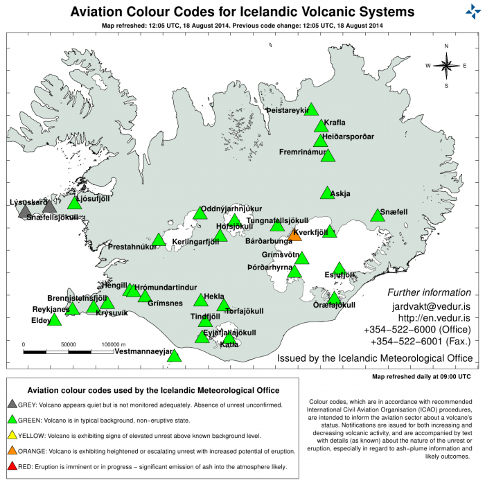
- The Icelandic Met Office has moved the aviation color-code from red to orange.
Seismic activity
There has been high seismic activity in Dyngjujökull in Norther Vatnajökull glacier since midnight. Over 700 earthquakes were detected from midnight to noon. Two earthquakes around and over 5 were detected in Bárðarbunga caldera. The first one, size 5,3 occurred at 00:09 HRS at the Northern edge of Bárðarbunga caldera. The latter occurred at 05:33 HRS, size ca. 5 at the Southern edge of the caldera. Both earthquakes happened at around 5 km depth.
Those are the largest events in the swirm that started over a week ago and also the largest earthquakes since before the eruption in Gjálp volcano in Vatnajökull glacier in 1996. The activity under Dyngjujökull has propagated northwards and is now mostly under the edge of the glacier, where an earthquake of size 4,2 was recorded this morning. The dyke under Dyngjujökull is now estimated to be approximately 30 km long.
There are no signs of an eruption. Observations show that a sub-glacial eruption did not occur yesterday. The intense low-frequency seismic signal observed yesterday has therefore other explanations.
Meetings and collaboration
The coordination of the operation continues at the National Crisis Coordination Center. Today a meeting was held with scientists where the situation was reassessed according to the latest information.
The closed area
Restrictions on roads and areas in Jökulsárgljúfur canyon up to Dettifoss waterfall is still in effect, as well as closures in the highlands North of Vatnajökull glacier. A map of the closed roads can be found on the website of the Icelandic Road and Coastal Administration http://www.vegagerdin.is/media/umferd-og-faerd/Halendi.pdf – The Icelandic Met Office has decreased the aviation color code to orange.
All restrictions on aviation have been cancelled. All scheduled services airports in Iceland are open.

